Parañaque River
Appearance
| Parañaque River Tambo River | |
|---|---|
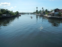
 The Parañaque River near its mouth in Manila Bay between barangays La Huerta (left) and Don Galo (right) before the construction of the LRT-1 Cavite Extension | |
Parañaque River mouth | |
| Native name | Ilog ng Parañaque (Tagalog) |
| Location | |
| Country | |
| Region | National Capital Region |
| Cities | |
| Physical characteristics | |
| Source | |
| • location | National Capital Region |
| Mouth | Manila Bay |
• location | Parañaque |
• coordinates | 14°30′8.4″N 120°59′21.3″E / 14.502333°N 120.989250°E |
• elevation | 0 m (0 ft) |
| Discharge | |
| • location | Manila Bay |
The Parañaque River (Tagalog: Ilog ng Parañaque), also known as the Tambo River, is a river in Metro Manila in the Philippines. It is located south of Manila passing through Pasay and Parañaque located near Ninoy Aquino International Airport.[citation needed] The river exits Manila Bay between the barangays of Don Galo and La Huerta just north of the Parañaque Cathedral.
See also
[edit]External links
[edit] Media related to Parañaque River at Wikimedia Commons


